

About Us
We prepare people, We save lives
Pre & Post-Earthquake preparation: strengthen your buildings safety
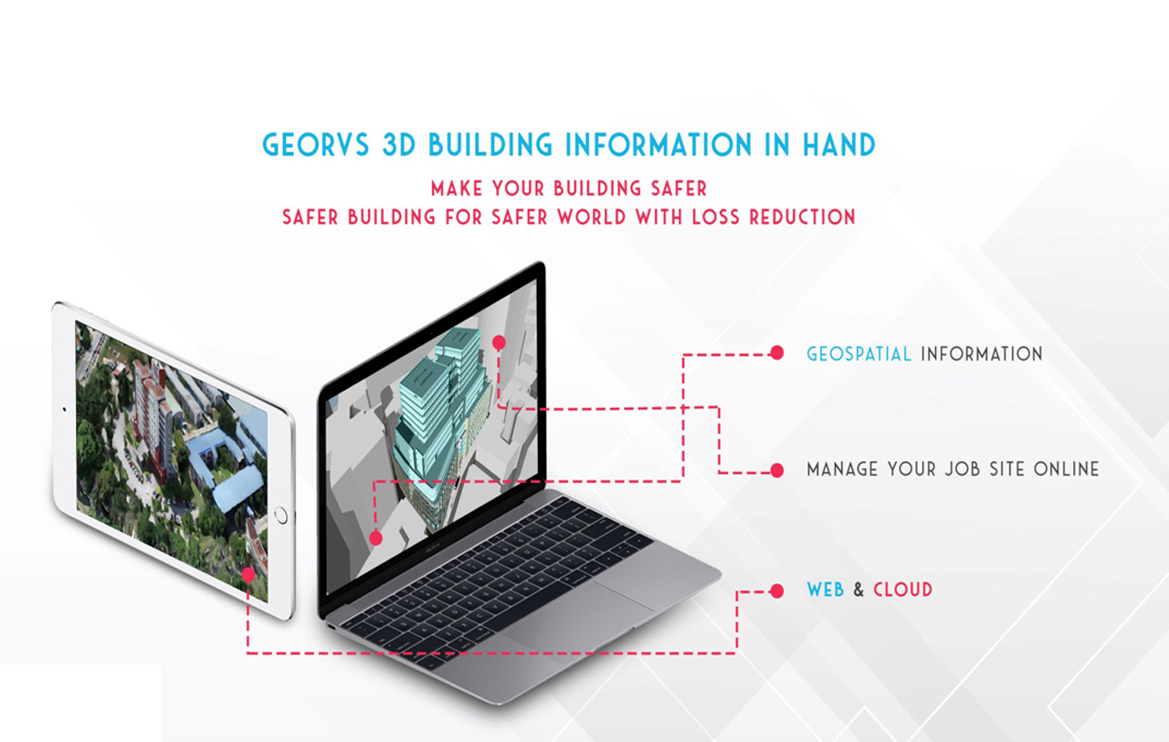
We are a startup risk assessment software company aiming to create safer buildings for a safer and better world. Our capacity building with an international expert team partner from academic and industry since 2007 privilege to work in the development of an integrated Geospatial Information-based Rapid Visual Screening (GeoRVS) and 3D reconstruction modelling Computer Vision platform.
We determine the vulnerability of buildings and estimation of risk and generate a 3D model for your building and applications beyond. The GeoRVS also provides subsidiary products such as 3D model, point clouds, Mesh, DEM, DTM, and Orthophotos.
Our objective is to deliver the risk assessment and 3D reconstructed user-friendly platforms to support academicians, research & development, practitioners, professionals, decision-makers, organizations, government bodies and private companies. We believe that the Geospatial Information-based Rapid Visual Screening (GeoRVS) can contribute to the Sustainable Development Goals (SDGs) 2030 in an actionable entrepreneurship and innovation way of utilizing geospatial for a better world, effectively. We also believe in the importance of the utilization of geospatial information for disaster risk reduction & emergency responses.
GeoRVS Features
3D real-world of your building
Screening buildings for potential seismic hazards with ability of 3D reconstruction model
Uniqueness
Simplifies Screening and Evaluation process
Unified solution (ability of screening for Level 1 and Level 2 from FEMA-154)

What We Do
1. GeoRVS determines the vulnerability of buildings and estimation of risk on site and in the office on the web and cloud.
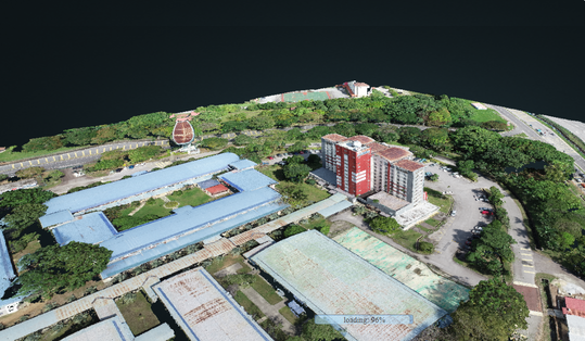
2. 3D reconstruction modelling computer vision from a video or images allowing users to generate point clouds, 3D models, digital elevation model (DEM), digital terrain model (DTM), mesh, and orthophotos on the web and cloud on site and in the office.
Frequently Asked Questions
-
How much do I need Geospatial Knowledge
to evaluate my building ?
You don't need to have any Geospatial or GIS Knowledge to evaluate your building for level one (FEMA-154).
GeoRVS
Geospatial Information-based Rapid Visual Screening
Canada
info@GeoRVS.com
+1-416-835-5930